Line Up
3D high precision point cloud data and maps

3D maps are expected to be used in various fields such as self-driving car, flight management of drones, and disaster prevention.
Aisan Technology has a track record of creating data for various locations with high-precision 3D measurement technology and map creation technology.
Leave it to AISAN TECHNOLOGY for 3D measurement and maps.
3D Mesurement
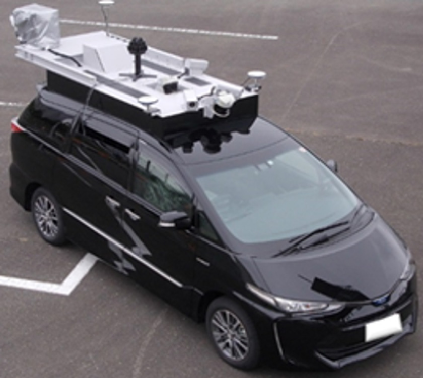
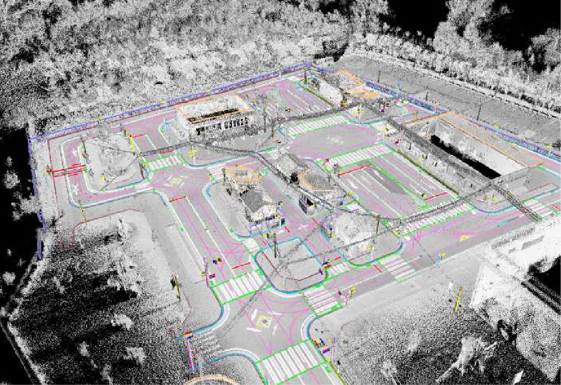
3D measurement system called MMS (Mobile Mapping System) can be created high-precision 3D maps records various surrounding environment information such as road shape, lane information, road signs, and crosswalks with laser, cameras, GNSS and inertial measurement devices.
3D high precision point cloud data and maps
Use case 1: self-driving car and drone
Self-driving car can be driven safety with matching 3Dmaps and detected object by the sensors. Drone can be flying also anyplace even under the ceiling and inside building.
ADASmap®
ADASmap® created by Pictures, point cloud and trajectory of GNSS measured by MMS is the high-definition map database.
Maps for autonomous driving are not sufficient with just the information "Which route is driving" like car navigation. In addition to being able to check which lane on the route you are driving, high accuracy is required to adapt to lane changes.
ADASmap® achieves the "cm-class" accuracy required for autonomous driving and ADAS (advanced driver assistance systems).
And ADASmap® already tested and used by many OEM/TIER1 companies and research institute of automotive industry.
ADASmap® is also available in “Autoware*”
ADASmap®
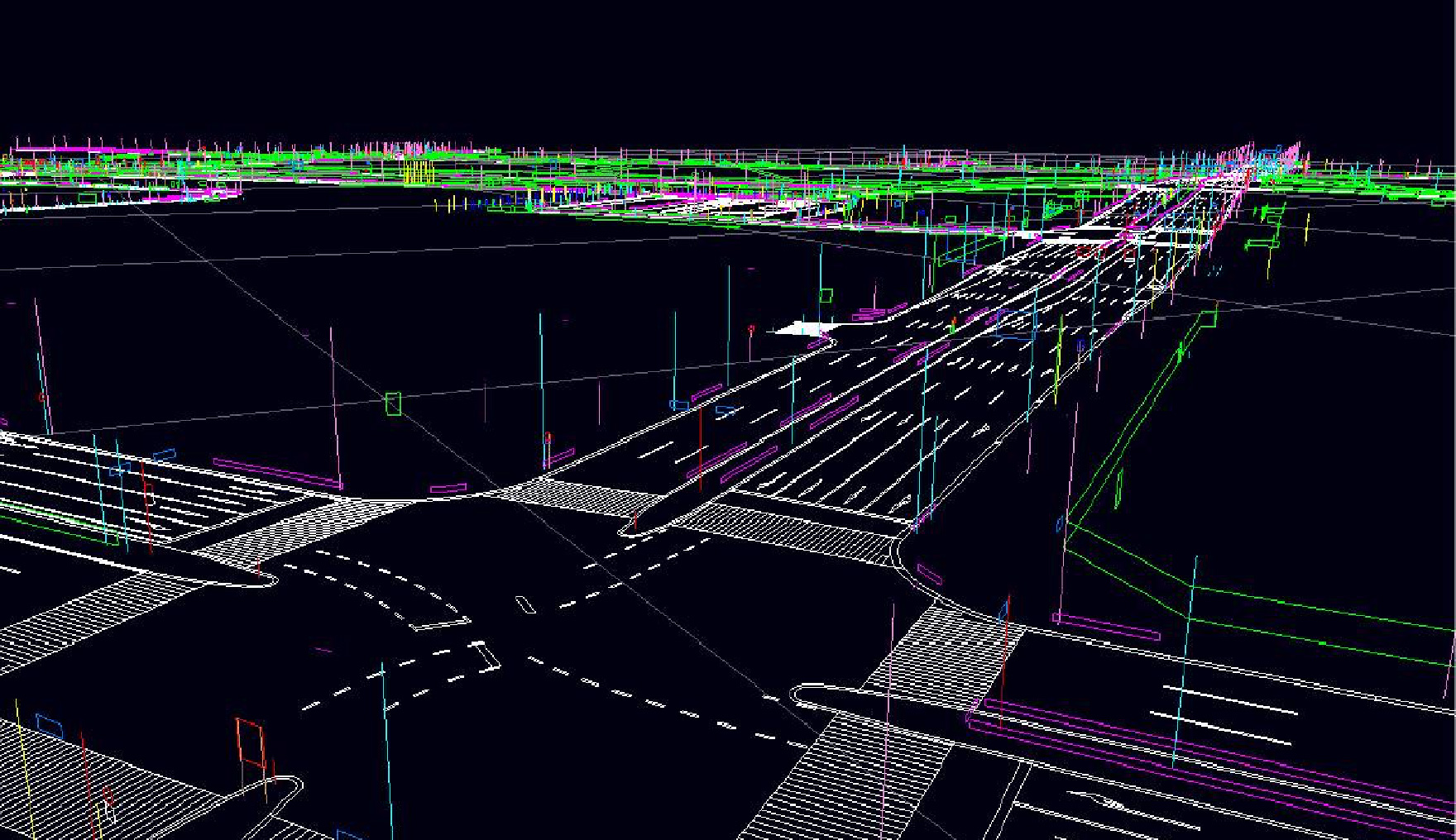
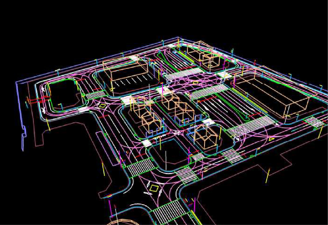
- ADASmap® Objects
- Real objects: lane marking, traffic sign, pole, guardrail, traffic light, etc.
- Virtual objects: lane center line, waypoint, curve, speed limit, slope, etc.
- Why ADASmap?
- High precision and high absolute position accuracy AISAN technology can keep high accuracy location to using multiple GNSS including Quasi-zenith satellite system.
- Graph accuracy that can be matched with recognition sensors with high accuracy.
Maintain accuracy of width, height, etc. of immovable stationary objects - Possession of 3D road alignment information
Reproduce road curvature information, longitudinal slope, and cross slope - Versatility
Available in various terminals/databases and map formats
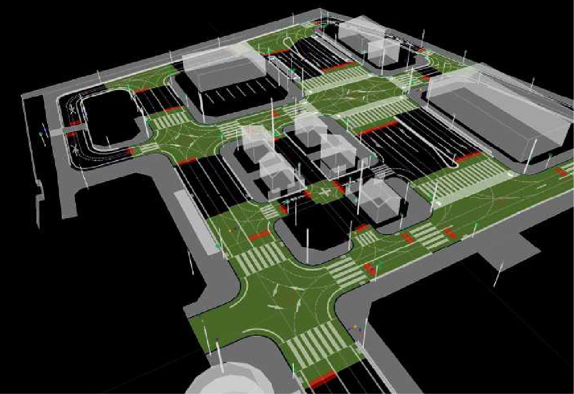
Use case 2: Driving Simulator
By loading the information created from ADASmap and point cloud data into the driving simulator, various evaluations and specification studies can be performed on the simulator without actual driving the vehicle.
OpenDRIVE® format compatible
Data can be converted to OpenDRIVE format using ADASmap and used for various functional evaluation simulations.
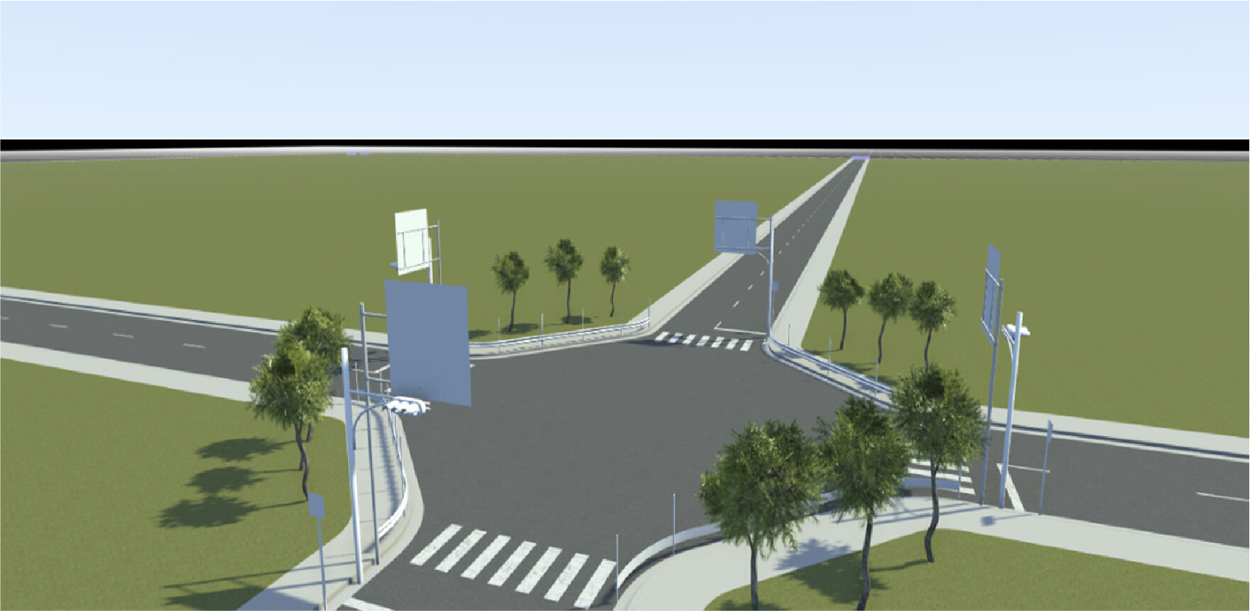
Image: EV-AICHI corporation
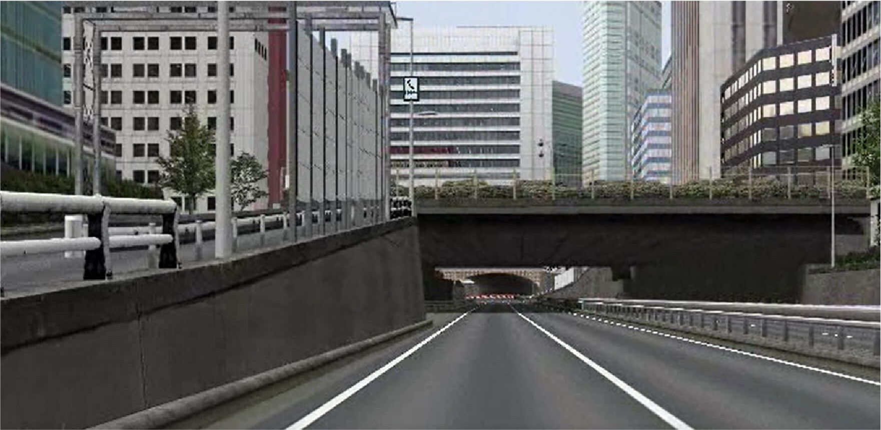
image: CAD CENTER CORPORATION
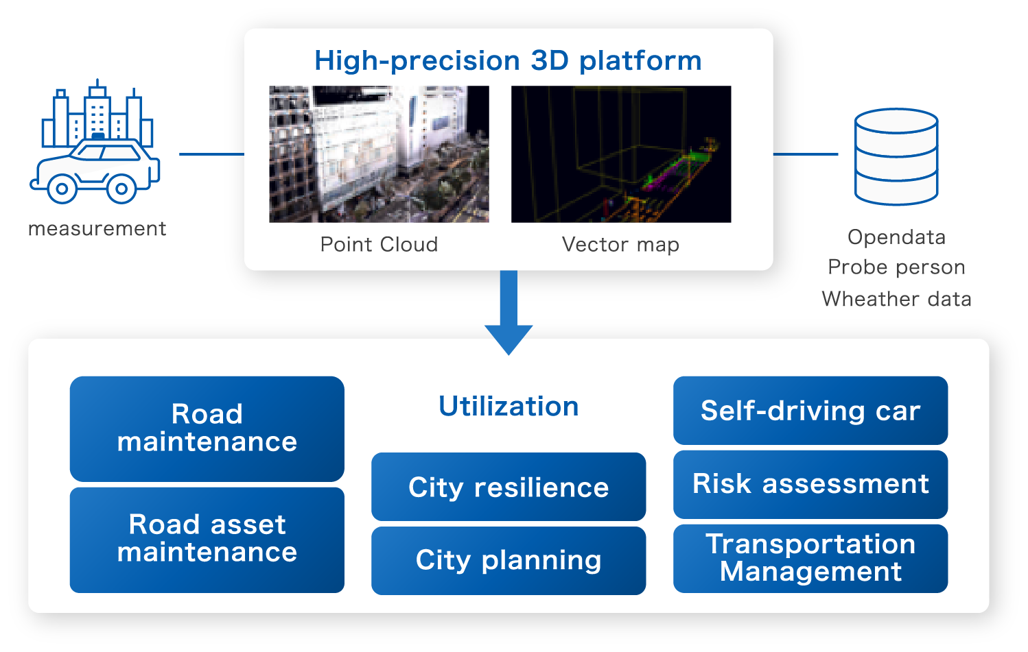
Use case 3: utilization for the infrastructure management
3D high precision map can be not just about moving cars autonomously, but also cooperating with the smart city management.
We have begun efforts to digitize high-precision 3D data measured for various purposes and build a high-precision 3D platform so that it can be widely used in infrastructure management and autonomous driving demonstrations.
For inquiries regarding product specifications, evaluation, or quotations, please fill in the questionnaire below and we will get back to you shortly.